Tìm hiểu về hệ thống hạ tầng logistics ở nước ta hiện nay
Hệ thống hạ tầng logistics ở nước ta hiện nay như thế nào? Nếu bạn đang thắc mắc câu hỏi này hãy cùng Proship chúng tôi tham khảo chi tiết câu trả lời dưới đây để cùng nắm bắt.
Hạ tầng giao thông đường bộ

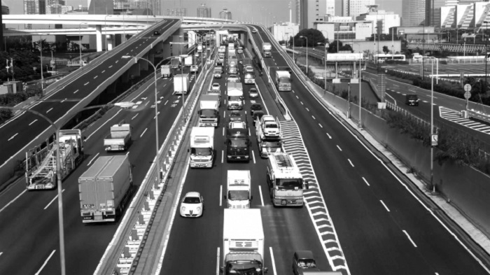
Hệ thống đường bộ Việt Nam hiện có tổng chiều dài 570.448 km, trong đó quốc lộ 24.136 km, đường cao tốc 816 km, đường tỉnh 25.741 km, còn lại là đường giao thông nông thôn (Bộ GTVT, 2018).
Trong năm 2018, kết cấu hạ tầng giao thông đường bộ có những bước phát triển mạnh, theo hướng hiện đại, có trọng tâm, trọng điểm, nhiều tuyến đường cao tốc, cầu lớn đã và đang được nâng cấp xây dựng tập trung vào các công trình có tính kết nối, lan tỏa, tạo động lực phát triển kinh tế – xã hội; trong đó nhiều dự án được đầu tư theo hình thức BOT, giảm áp lực rất lớn cho nguồn vốn ngân sách Nhà nước. Đặc biệt, Bộ GTVT đã triển khai nhiều giải pháp để đẩy nhanh tiến độ xây dựng một số đoạn đường bộ cao tốc trên tuyến Bắc – Nam phía đông giai đoạn 2017-2020. Toàn tuyến cao tốc Bắc – Nam được chia thành 11 đoạn, tuyến, trong đó 3 đoạn sử dụng toàn bộ vốn ngân sách Nhà nước và 8 đoạn đầu tư theo hình thức hợp tác công – tư (PPP).
Hạ tầng giao thông đường sắt

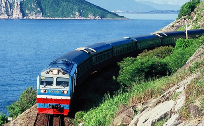
Mạng lưới đường sắt quốc gia Việt Nam có 7 tuyến chính với tổng chiều dài gần 3.160 km, mật độ đạt 7,9 km/1000 km2 , trong đó 2.646 km đường chính tuyến và 514 km đường ga/nhánh (Xem Bảng 4), bao gồm 3 loại khổ ray mà chủ yếu là khổ đường 1,000 mm (chiếm 84%), còn lại là khổ đường 1.435 mm (6%) và khổ đường lồng (9%).
Trong giai đoạn vừa qua, ngành Đường sắt Việt Nam (ĐSVN) đã triển khai xây dựng mới một số hạng mục hạ tầng như nâng cấp một số ga, nâng cấp một số tuyến để nâng cao an toàn, rút ngắn thời gian chạy tàu. Hiện nay, diện tích nhà ga, kho ga phục vụ vận chuyển đường sắt và trung chuyển với các phương thức vận tải khác vào khoảng 2.055.110 m2 . Diện tích ke ga, bãi hàng vào khoảng 1.377.621 m2 . Trong đó có các nhà ga, kho ga lớn với sức sức chứa lớn, hiện đại như:
- Nhà Ga: ga Hà Nội, ga Giáp Bát, ga Ninh Bình, ga Thanh Hóa, ga Đà Nẵng, ga Sài Gòn…
- Kho ga: Nhà kho 10 ga Hải Phòng; kho hành lý Ga Hà Nội; kho hàng lẻ ga Giáp Bát…
Hạ tầng giao thông đường thủy nội địa

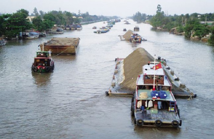
Về các tuyến đường thủy nội địa Việt Nam là quốc gia được thiên nhiên ưu đãi, có tới 2.360 con sông, kênh lớn nhỏ với tổng chiều dài khoảng 41.900 km, mật độ bình quân 0,27 km/1 km2 , có 124 cửa sông, là một nước có mật độ sông, kênh vào loại lớn trên thế giới. Tổng chiều dài đường thủy nội địa toàn quốc đang quản lý khai thác là 17.253 km, Trung ương quản lý các tuyến đường thủy nội địa quốc gia với tổng chiều dài khoảng 7.071,8 km (chiếm 41% tổng chiều dài đường thủy nội địa đang khai thác, quản lý của cả nước). Đây là những tuyến vận tải huyết mạch kết nối các trung tâm kinh tế, khu công nghiệp lớn của khu vực và cả nước (Bộ GTVT, 2018).
Khu vực Miền Bắc:
Luồng tuyến đường thủy Miền Bắc chủ yếu là trên sông Hồng, sông Đuống, sông Thái Bình và sông Luộc. Mạng lưới giao thông đường thủy kết nối các tỉnh khu vực đồng bằng sông Hồng với khu vực cảng biển Hải Phòng và Quảng Ninh, kết nối với các tỉnh Trung du miền núi phía Bắc qua sông Lô. Ngoài ra Quảng Ninh còn là đỉểm đẩu của tuyến vận tải sông pha biển từ Bắc vào Nam nhằm san sẻ gánh nặng cho đường bộ.
Khu vực Miền Trung:
Chủ yếu là các tuyến đường thủy nội địa độc lập hoặc chỉ trong phạm vi địa bàn từng tỉnh (từ tỉnh Thanh Hóa đến Quảng Nam). Các tuyến sông có địa hình dốc, nối từ cửa biển vào sâu trong nội địa đến các huyện vùng sâu của địa phương, ở các vùng này hàng năm vào mùa mưa lũ thường chịu ảnh hưởng rất lớn của lũ ống, lũ quét, mực nước các sông dâng lên cao rất nhanh, dòng chảy mạnh nhưng mực nước cũng hạ xuống rất nhanh (chỉ sau lũ vài ngày). Phạm vi khai thác vận tải cho tàu sông biển chủ yếu từ quốc lộ 1 trở ra biển, một số tỉnh có các tuyến sông có khả năng vận tải thủy vào sâu trong nội địa.
Khu vực Miền Nam:
Các tuyến đường thủy nội địa quốc gia hiện do Trung ương quản lý là 2.968,9 km. Mạng lưới sông kênh với mật độ lớn, chảy qua hầu hết các trung tâm kinh tế, đô thị, các khu công nghiệp, nối liền các cảng sông, cảng biển, thông ra biển theo nhiều cửa sông tạo thành các trục vận tải thuỷ thuận lợi. Giao thông đường thủy ở đồng bằng Nam Bộ rất phát triển. Hàng năm đường thủy vận chuyển chiếm 65-70% về tấn và 70-75% về tấn/km trong vận tải hàng hóa của toàn vùng. Mạng lưới sông khu vực phía Nam được hình thành bởi hai hệ thống sông chính là hệ thống sông Đồng Nai và hệ thống sông Cửu Long. Hai hệ thống sông này được nối với nhau bởi các kênh có mật độ vận tải lớn như kênh Chợ Gạo, kênh Lấp Vò – Sa Đéc, kênh Hồng Ngự, kênh Tân Châu, kênh Vĩnh Tế.
Hạ tầng giao thông đường hàng không
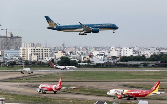
Theo Quyết định 236/QĐ-TTg được Thủ tướng phê duyệt ngày 23/2/2018, đến năm 2030, Việt Nam sẽ khai thác tổng cộng 28 sân bay gồm 15 sân bay quốc nội và 13 sân bay quốc tế, trong đó Nội Bài, Đà Nẵng, Cam Ranh, Tân Sơn Nhất, Long Thành là các cửa ngõ quốc tế trọng điểm. Dự kiến, đến năm 2020, tổng sản lượng thông qua các cảng hàng không đạt khoảng 131 triệu hành khách/năm và 2,2 triệu tấn hàng hóa/năm. Hàng không Việt Nam đang hướng tới mục tiêu đứng thư tư trong ASEAN về sản lượng vận chuyển, phát triển đội tàu bay và hệ thống cảng hàng không (Bộ GTVT, 2018).

Để đáp ứng tốc độ tăng trưởng cao của ngành hàng không, Quyết định 236 đã đưa ra các định hướng quy hoạch phát triển theo hướng bền vững, đẩy mạnh hội nhập quốc tế; huy động tối đa mọi nguồn lực phát triển kết cấu hạ tầng hàng không; đẩy mạnh lộ trình tự do hóa vận tải hàng không trên cơ sở song phương, đa phương…Bên cạnh đó, quy hoạch cũng tập trung cho phát triển thêm các đường bay theo mô hình hoạt động “điểm – điểm”; khuyến khích việc mở các chuyến bay quốc tế đi/đến các cảng hàng không có nhu cầu và tiềm năng phát triển du lịch…; bổ sung định hướng phát triển mạng đường bay theo mô hình vận tải đa phương thức…; điều chỉnh quy hoạch số lượng cảng hàng không khai thác; phát triển các trung tâm logistics chuyên dụng hàng không; cập nhật Kế hoạch không vận mới của ICAO; bổ sung quy hoạch về bảo vệ môi trường.
Hiện có 22 cảng hàng không đang hoạt động, trong đó có 9 cảng hàng không quốc tế, 13 cảng hàng không nội địa. Trong 22 cảng hàng không này, thì cảng hàng không quốc tế Vân Đồn mới đi vào hoạt động năm 2018.
Những thông tin trên đây đã giúp bạn đểm qua được hệ thống hạ tầng logistics ở nước ta hiện nay. Theo đó, nếu có nhu cầu sử dụng dịch vụ vận chuyển hàng hóa nội địa, chuyển phát nhanh của Proship hãy liên hệ với chúng tôi để được hỗ trợ.
📦 Hotline Liên Hệ Vận Chuyển
🧭 Miền Trung

